
ROAD TRIP · WATERFALLS · COFFEE · SOUTHERN LAOS
Bolaven Plateau
The plateau is not one attraction. It is the road out of Pakse: cooler air, coffee country, villages and waterfalls spread far enough apart that the journey becomes the point.
- 01Pakse
- 02Waterfalls
- 03Coffee
- 04Tad Lo
- 05Return
fewer pins → better loop

THE FEELING OF THE ROAD
Leave Pakse before the loop becomes a checklist.
The Bolaven Plateau is not one single attraction. It is a road journey through waterfalls, coffee country, villages and cooler highland landscapes. The best experience comes from choosing a rhythm before choosing individual stops.
The first mistake is trying to make every waterfall equally important. Distances, weather, coffee stops and the roads between villages are what shape the day. A good loop leaves margin for a stop you did not plan.
WHAT CHANGES ABOVE PAKSE
Cooler air, wetter roads and a different rhythm.
A highland road of coffee farms, forest, villages and waterfalls. The plateau works best as a journey between stops rather than a single attraction.
Start early. Rain and mist can arrive quickly, especially in the wet season.

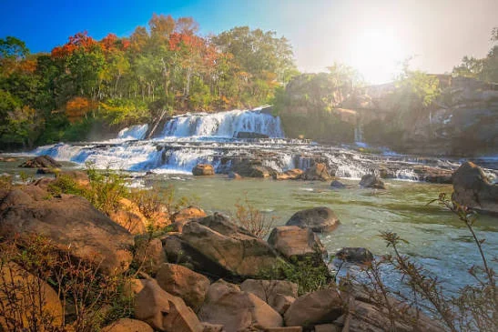
WATERFALL DAYS
The waterfall is a stop. The plateau is the journey.
Choose a small number of falls that fit the road you actually want to ride. Paths can become wet and slippery, and a stop that looks ten minutes long on the map can easily absorb an hour once you walk down, take photographs and wait out a shower.
Light layers, a rain jacket and shoes suitable for wet waterfall paths.
The loop is the experience. Follow the road, not the number of pins.
PLAN THE LOOP
One day, or sleep on the plateau?
1 day minimum · 2–3 days ideal. The longer version is less about adding more pins than removing the pressure to rush back to Pakse.
How to get there
Begin in Pakse with a reliable scooter, motorbike or private driver. Leave early, check the weather and decide whether you are following the shorter southern route or continuing into a slower multi-day loop. Download the important map points before leaving town because reception can become irregular between stops.
What the budget feels like
The journey itself can stay inexpensive. The main costs are transport, fuel, food, coffee stops and small entrance fees at individual waterfalls. A private driver raises the budget considerably, while a shared room and scooter keep it low. Carry cash in small notes for remote stops.
How long to keep
A full day works for a compact introduction, but it requires an early departure and selective stops. Two or three days are more comfortable if you want to continue toward Tad Lo, sleep on the plateau and avoid riding the final section after dark.
How to approach it
Choose fewer waterfalls and leave space for the roads between them. Rain can arrive quickly, paths become slippery and the temperature is often cooler than Pakse. Pack a light rain layer, shoes that can get wet and enough water for the quieter sections.
QUESTIONS BEFORE THE ROAD
Bolaven Plateau, practically
The useful decisions are simple: how long, how you travel, how late you ride and how many stops you are willing to skip.
Can I see the Bolaven Plateau in one day?
Yes, but keep the route selective. A full day can introduce the plateau from Pakse, while two or three days is better for Tad Lo, coffee stops and a slower return.
Do I need a scooter?
No. Scooter or motorbike is common, but a private driver also works. The important point is to decide the route and return timing before leaving Pakse.
What should I carry?
Cash in small notes, water, a light rain layer, sun protection and shoes that can handle wet waterfall paths. Save important map points offline.
Is the road difficult?
The main roads are generally straightforward, but conditions vary with rain, construction and the side roads used for individual waterfalls. Avoid building a schedule that forces you to ride after dark.
What is the point of the loop?
The road itself. Waterfalls matter, but so do the cooler air, coffee country, villages and the change from Pakse into the highlands.
KEEP EXPLORING SOUTHERN LAOS
After the highlands?
Keep moving through the same southern Laos notebook without returning to a generic menu.

KEEP IT IN THE NOTEBOOK
Save the Bolaven Plateau for the road.
Add the loop to My Trip now, or open the map when you are ready to build the route.